
Easy Diving with Navigation
Certification Card
Navigation Type
Surface Natural Navigation
Surface Compass Navigation
Underwater Natural Navigation 1
Underwater Natural Navigation 2
Underwater Compass Navigation 1
Underwater Compass Navigation 2
Underwater Compass Navigation 3
Underwater Compass Navigation 4
Underwater Compass Navigation 5
|

|
|
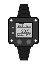
This method allows you to determine your underwater position
by using diving instruments such as a compass and gauges.
|
|
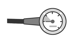
● Water Depth and Temperature
When the bottom topography is simple,
shallower water generally indicates you are closer to shore,
while increasing depth usually means you are moving offshore.
Always confirm your depth using a depth gauge.
|
|
|
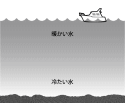
Water temperature may change due to river inflow,
spring water, or variations in depth.
|
|
| |
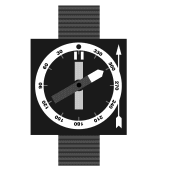
● Compass Bearing
Use a compass to monitor and maintain your heading.
Accurate bearing control is essential for precise navigation.
|
|
| |
● Underwater Travel Time
If you swim at a consistent speed,
the distance traveled within a specific time period will remain relatively constant.
By tracking time, you can estimate the distance covered.
|
|
| |
● Submersible Pressure Gauge (SPG)
At a constant depth, air consumption is approximately proportional to distance traveled.
On an out-and-back dive at similar depths,
air usage for the outbound and return segments is often similar.
It is helpful to know your approximate air consumption rate
per unit of distance in advance.
|
|
| |
● Fin Kick Cycles
You can estimate distance by counting fin kicks.
Measure the approximate distance covered per kick cycle in advance
for greater accuracy.
|
|
|
|


|
|